Alaska Trends
n its Sustainable Investment Opportunities report from October 2022, the Arctic Economic Council (AEC) stated, “The Arctic has always been connected to the rest of the world via trade for centuries. Indigenous communities traded with each other across vast distances and the Vikings traded across the region. Walrus ivory from Greenland was sold in England centuries ago, while whale oil from the Bering Sea lit the streets of American cities.”
To acknowledge the role of business in the region, the Arctic Council intergovernmental forum created the AEC in 2014 as an independent business membership organization. Multinational corporations and small entrepreneurs join forces to facilitate partnerships, develop policies, and promote sustainable economic development in the Arctic.
The 2022 report showcases a selection of opportunities, including some in Alaska. In addition to GCI’s AU-Aleutians Fiber Project, air cargo improvements at Ted Stevens Anchorage International Airport, and the Ambler Metals mining prospect, the report spotlights a software startup. PolArctic, the brainchild of two Alaskans, is creating a system to forecast sea ice breakup and refreeze a year in advance.
One of AEC’s recommendations for action is that local and regional chambers of commerce should host investor meetings outside of the Arctic region. By going where the large financial institutions are, Arctic communities bring news of the opportunities for local investments.
This edition of Alaska Trends illustrates the top-of-the-world view from the AEC report.
Or 20 million square kilometers encompass 8 Arctic nations. Of the 4 million Arctic inhabitants, 10% are Indigenous, representing more than 40 ethnic groups.
The Arctic’s road networks are very sparse, with only 20% of Alaska accessible by road and zero roads between the cities of Greenland.

350 ports serve the maritime needs of the Arctic. Approximately 200 of these ports remain ice-free year-round.

There are 1,300 within the Arctic Circle; 267 large and medium sized airports facilitate most passenger travel.
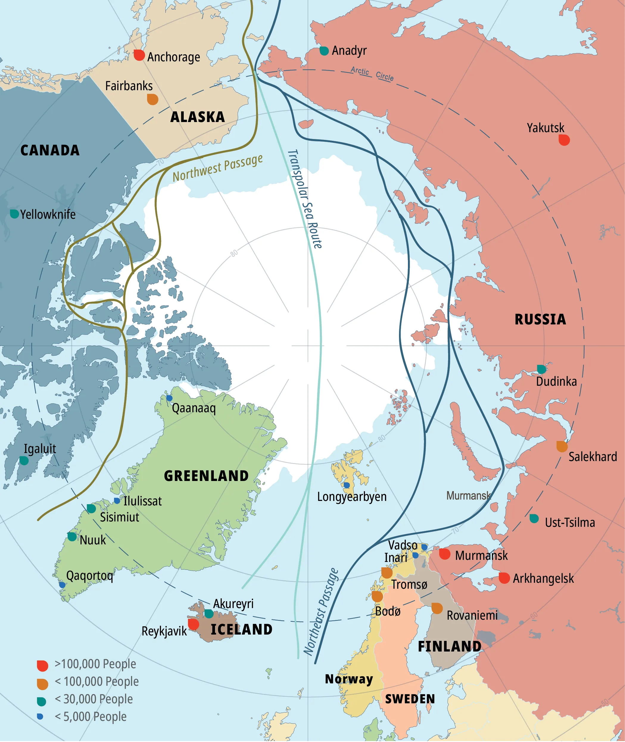
The Arctic connects more than 80% of the world’s economy with increasingly accessible shipping channels.
Infrastructure requirements in the Arctic region alone are expected to reach nearly $1 trillion over the next 15 years.