f you take a drive along the Steese Highway north of Fairbanks on a sunny summer afternoon, the landscape alternates between lushly forested hills and bare, twisting mounds of rock sprinkled with scrubby trees and brush on the valley floors.
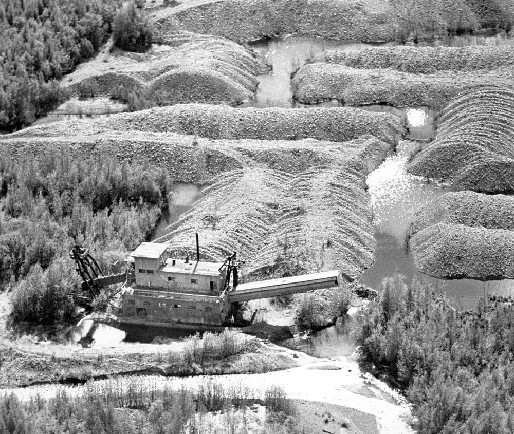
These mounds of rock, which sometimes extend for miles, are the result of gold mining using bucket dredges from the ‘30s to the ‘70s. These giant machines, some of which are still scattered among Alaska’s historic placer mining sites, picked up the gold-bearing earth in huge buckets, sifted out the gold and dumped the tons of waste rock in long ropy strands behind it. Decades later, those lines of mine tailings are stark evidence of the industry, which at the time had no rules about reclaiming the land after mining.
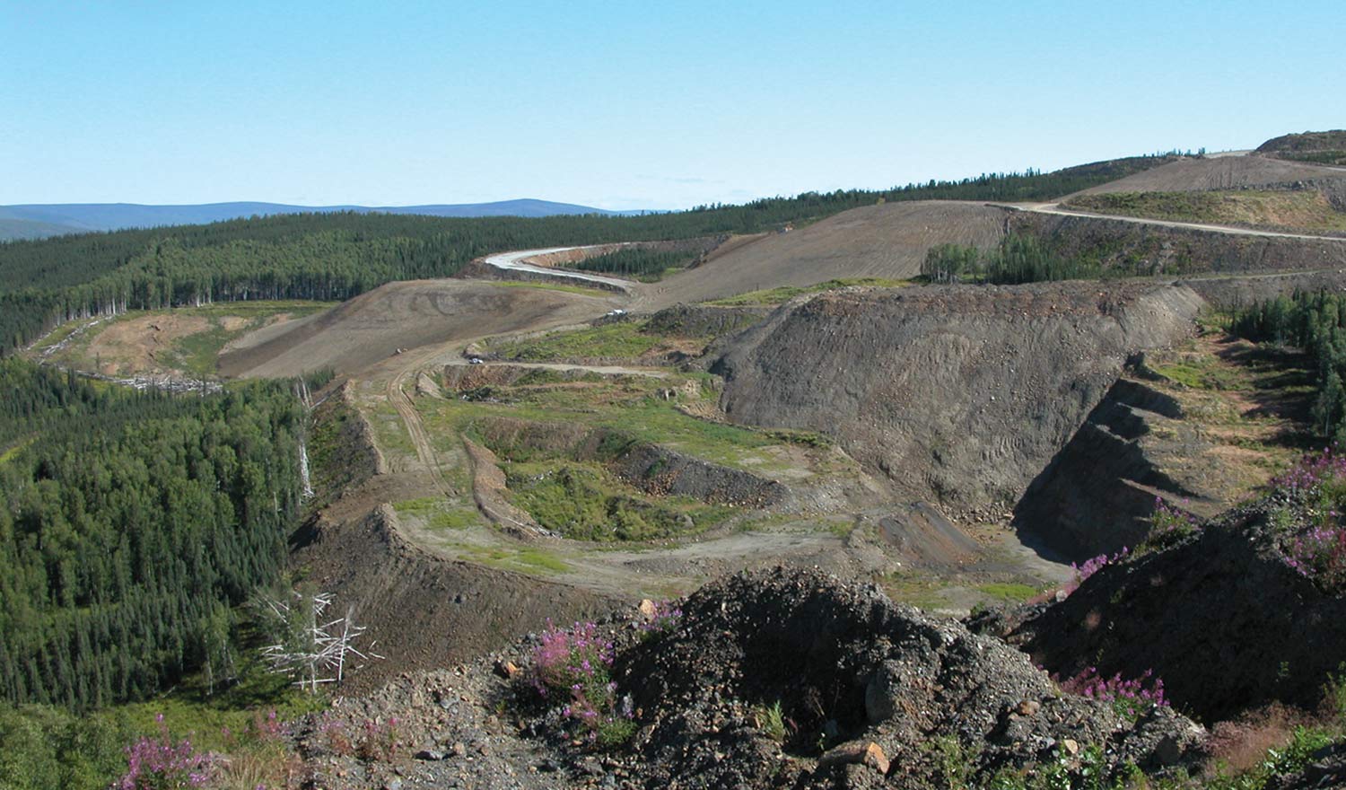
Times have changed. A few miles up the Steese Highway is a green, grassy hillside that was the site of another mine twenty years ago. True North mine was active between 2001 and 2004. Kinross, which operates the larger Fort Knox gold mine 7 miles south, produced 11.7 million tons of gold ore from the 2,050 acre site, which yielded 490,000 ounces of gold from the milling operations at Fort Knox.
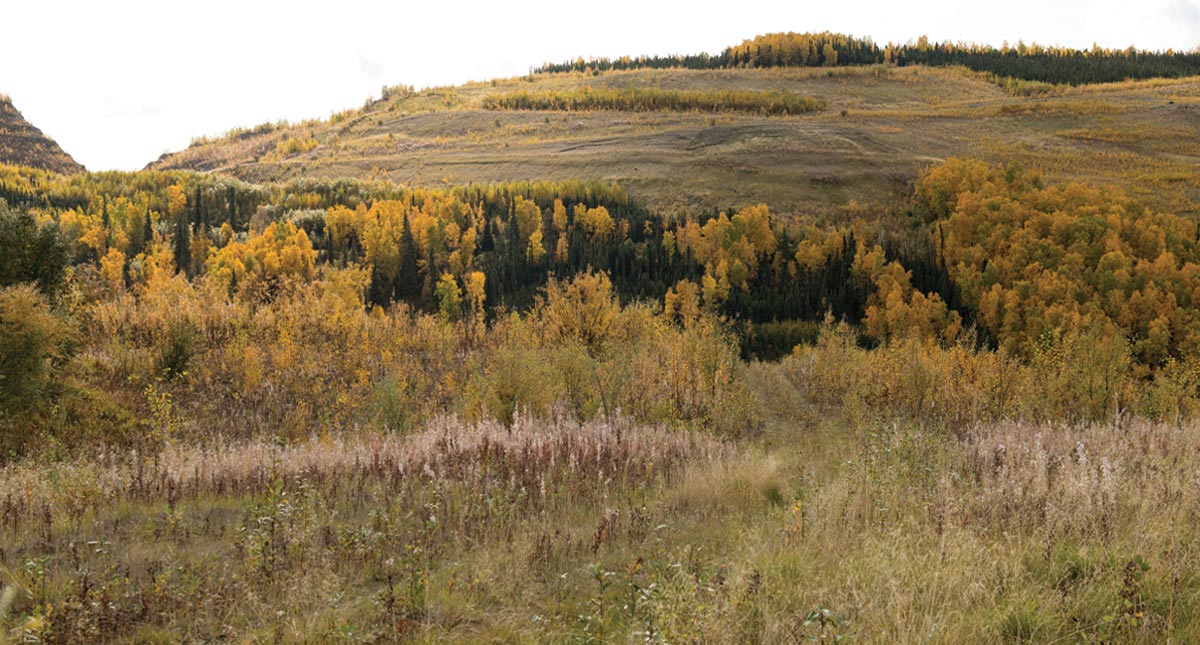
Before mining began, Kinross had submitted a site reclamation plan to the Department of Natural Resources. When mining operations ended, Kinross started remediating the site, 615 acres of which had been directly affected by mining operations. Over the next six years, the site was graded and recontoured, reseeded and fertilized, and all mining structures were removed. Native trees and plants were reintroduced. The site was then monitored for several years to ensure the landscape was stabilized.
Today, it’s just another green, grassy hillside, “Which is the whole point of reclamation,” says Alaska Department of Natural Resources (DNR) spokesman Dan Saddler.
“Alaska’s founders knew responsible resource development was key to a secure and prosperous state, and our experience with True North shows that they were right,” DNR Commissioner Corri Feige says. “The developers leased state land, produced a valuable commodity to serve global markets, employed Alaskans, and paid state taxes and royalties. When they were done, they remediated the effects of their work and returned the land to the state for its next use. The system works.”
The “system” is a rigorous set of studies and requirements overseen by an alphabet soup of state and federal agencies designed to ensure development does not harm the environment and that if an area is disturbed during development, it is restored to as close to its natural state as possible after operations end or other mitigation processes are employed. It’s a process that isn’t confined to mining but applies to any development such as roads, pipelines, construction—anything with the potential to affect water and air quality, wetlands, wildlife, cultural resources, and more.
According to Suzanne Settle, vice president of energy, land, and resources for CIRI, the corporation began looking at options for a commercial wind farm in the late ‘90s. She has been involved since 2009. CIRI had selected Fire Island as part of its land allocation under the Alaska Native Claims Settlement Act, and it proved to be a good place for the wind farm: it’s adjacent to Anchorage, but not in Anchorage; there’s no competing use for the land; and it’s offset enough from town that people didn’t get riled up about the turbines in view.
In addition, Fire Island has reliable winds, is near the Railbelt power grid, and had minimal environmental factors.
Minimal, however, certainly doesn’t mean none. Multiple permits and studies were required before, during, and after construction. That’s where Midnight Sun Environmental came in.
Brian Kovol, vice president of Midnight Sun Environmental, as well as the principal scientist and project manager, says a project with a primary-type of impact, like building in wetlands, has different requirements and mitigation issues than a secondary impact that may be related to dealing with contaminated water.
News-Miner Archive
News-Miner Archive

“There were probably sixty different permits and authorizations we had to get for that project,” he says. “A lot of different stakeholders were involved.”
Required permits include coastal zone; the US Corps of Engineers Section 404 permit that regulates the discharge of dredged or fill materials in water or wetlands; NEPA environmental assessments; and permits for potential impacts to bald eagles and endangered species, such as the Cook Inlet beluga whale. They also had to evaluate whether the project would impede operations at the nearby Anchorage Ted Stevens International Airport. Even after construction, surveys of bird mortality and bald eagle nests were required.
After the project was built, more studies were done to establish the turbines’ actual impact on migratory birds.
“In Fire Island’s case, it was really interesting,” he says. “There’s a major flyway over Fire Island and there was a lot of concern early on that there would be a lot of impact based on what they’ve seen in the Lower 48. But what they actually found was there were very few birds being killed. Mainly we found out that when the weather’s bad, the birds don’t fly, so they’re only flying in fairly good weather and they could see the wind turbines.”
Wetlands mitigation is a huge issue in Alaska because the state is three-quarters wetlands, he says. Even the Eva Creek Wind Farm, the state’s largest, located on a mountain north of Healy, is on alpine wetlands.
In Anchorage, there’s a methodology to deal with wetlands mitigation. It assigns a number of debits to a fill that vary depending on the quality assessed of that wetland. A fishery might mean a high assessment while a landfill in a low-quality wetland might be lower. Credits are assigned to offset that.
Mitigation banks have been set up where developers pay a fee to someone to offset the mitigation. In Anchorage, that’s the Great Land Trust or Harmony Ranch wetlands bank. It’s also possible no mitigation is needed for a project.
“Those are the discussions that go on during the permitting process,” he says.
“You have these spinning turbine blades that are traveling at the speed of a propeller in a [Cessna] 172,” Kovol says.
Radar operators tracking aircraft coming in and out of Anchorage kept seeing “stationary aircraft”—the turbines.
“There was a lot of mitigation work that had to go into how to address that,” he says. “And it’s not just Anchorage International. You have aircraft coming into and out of Elmendorf. There was quite a bit of discussion.
“I think there’s opportunity for future development and wind technology has improved and the cost has come down, so adding more turbines would be more cost-effective.”
Land and Resources, CIRI
Kinross Alaska

Richard Armstrong.
Kinross Alaska

Richard Armstrong.
“We had to convince the FAA to allow us, as a private contractor, to build a new navigational aid at the airport,” she says. The technology of the navigational equipment on Fire Island was outdated and due to be replaced, but not on the schedule CIRI needed to install the wind turbines. CIRI paid for the new installation at the airport.
“We felt it was a good investment for us to have that device off the island,” Settle says. “That was certainly a huge challenge.”
The move turned out to be a benefit for pilots, Kovol says.
“If you’re an aircraft in bad weather, flying, trying to find the landing strip, you’re probably not going to want to fly to Fire Island, you’re going to want to fly to the airport,” he says. “But to get that done was a Herculean effort. That was one of the major issues that had to be resolved with that project.”
Because the population of beluga whales in Cook Inlet is listed as endangered, Kovol says they had to do a lot of modeling to make sure the project complied with the Endangered Species Act.
They also had to take a look at how the project would affect a potential expansion of the Anchorage airport.
“We’re putting transmission lines in the dog park that’s adjacent to Anchorage International. You’ve got a lot of user groups there that were impacted,” he says. “So there was a lot to pack and unpack with that.”
Overall, CIRI has been very happy with Fire Island, Settle says.
“I’m always so proud every time I see that project and remember how challenging it was,” she says. “I think there’s always lessons learned. I think there’s opportunity for future development and wind technology has improved and the cost has come down, so adding more turbines would be more cost-effective.”
Any federal permit that is issued is required to go through the NEPA process, and part of that NEPA process deals with avoidance, minimization, and mitigation measures.
Timelines can vary greatly.
In general, a basic Corps of Engineers permit is expected to take 120 days, but it frequently runs longer if there are questions from the agencies. On the other hand, sometimes it only takes half as long if the project is cut and dried.
However, the process differs depending on the project size and how controversial it is. Permits for small projects are often approved quickly. Larger, generally popular projects such as Fire Island require an environmental assessment, which has public notice requirements and take one to three years. Other large projects that are more controversial, such as a major mine or gas line, must go through an Environmental Impact Statement process, which can take from two to ten years.
With some very controversial projects, approval can take even longer.
Kovol says Midnight Sun Environmental has been working on a project in Cordova, a 4.5 mile road to a new oil spill response facility at Shepard Point, which just received $40 million in funding. That project dates back to the 1992 Alyeska Consent Decree that designated funding for the facility in the wake of the 1989 Exxon Valdez oil spill.
After more than sixteen years of studies by state and federal agencies, the final major permit, the 404 permit that is required for the discharge of materials into wetlands and water bodies, was issued.
“There was a lot of controversy over building it and where it should be placed,” he says. “Ultimately, it took twenty years to get through that environmental review process and mitigate all of the concerns that were out there. That may be the longest project I’ve ever worked on.” ![]()