Alaska Trends
efore Ship Creek in Anchorage became a railroad construction base in 1915, the largest community in upper Cook Inlet was Knik. What people might not appreciate is that, although the population crown has shifted across the arm, Knik still comes in second.
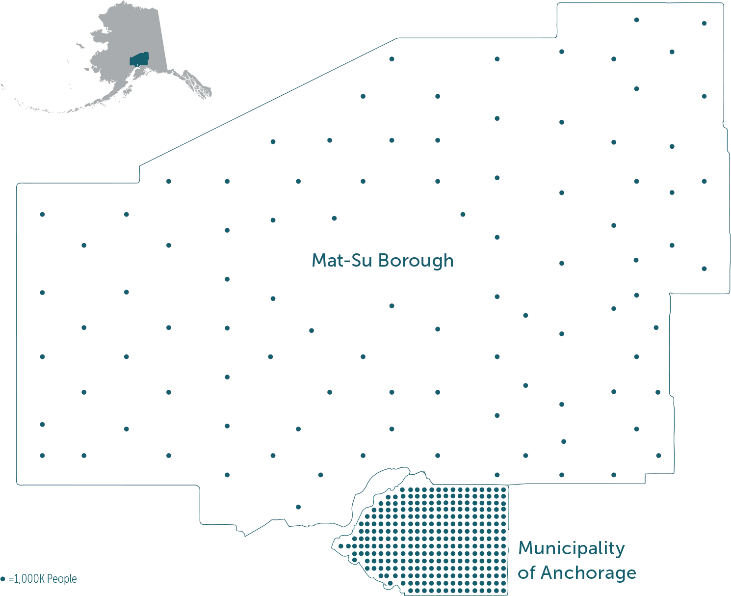
It’s true: Knik-Fairview is the most populous census-designated place (CDP) in all of Alaska, with 19,297 residents in 2020, more than double the 9,054 residents in neighboring Wasilla. Fellow unincorporated areas North Lakes and Meadow Lakes likewise dwarf their incorporated neighbor, while the city of Palmer has fewer people than the non-city of Tanaina. The Gateway, South Lakes, and Fishhook neighborhoods rank among the state’s most populated places, too, despite having such a low profile that some residents never heard those names before. (The US Census Bureau split the “Lakes” area into north and south tracts for the 2020 census.)
The Matanuska-Susitna Borough is surprisingly vast. The watersheds of its namesake rivers encompass as much land as West Virginia, stretching the borough’s boundaries from Lake Louise in the east to the headwaters of the Skwentna and Yentna Rivers in the west, and from Susitna Glacier on the north side of the Denali Highway to the river delta just outside Chugach Electric Association’s Beluga power station.
This month’s article “Where the Patients Are” describes healthcare services coming to the Mat-Su in response to the area’s continued population growth. Services and amenities naturally fill in as demand builds, and in the Mat-Su many services—like healthcare—are overdue.
One reason why some services may lag behind is that the majority of Mat-Su’s growth is invisible from the Parks or Glenn Highways; casual passersby may never notice it. Many of the region’s residents find it attractive because of the privacy that it offers. But highway or no, census takers go wherever there are people to count, allowing Alaska Trends to peek over the proverbial fence at the state’s quietly booming boomtowns.
27
census-designated places
3
incorporated cities
24,618
square miles
107,081
people
51,077
housing units
As of the 2020 census, the population increased by 18,086 since 2010, the fastest rate of any political subdivision in Alaska.
The most populous census-designated place in the Mat-Su Borough is Knik-Fairview.
9.8% of residents being military veterans compares to 6.4% nationally.
The Mat-Su Borough’s population growth in the last decade outpaced the statewide rate of 2.6%.
under 5 years
under 18 years
18-55 years
65+ years

$79,300
median household income
$35,929
per capita income
This is 10.8% less than the median household income of $88,871 in Anchorage.

As the Mat-Su Borough population grows, so does its impact on Alaska’s economy. The 2020 census reported a
3.4%
growth in employment
20,594
total employment
$1 Billion
annual payroll
The fastest growing population in the Mat-Su Borough was in the 65+ age group, up 104.4% since 2010.

As the Mat-Su Borough grows, so does its population below the poverty line. 10.5% Mat-Su residents lived below the poverty line in 2017 compared to 9.5% of Anchorage residents in 2017.
The average resident spends 36 minutes in travel time to work.
The graph shows the population in each CDP and incorporated city in the last three censuses. Note that North Lakes and South Lakes were counted together until 2020.