Construction
Big changes could be in store for far north communities
By Brad Joyal
Construction
Big changes could be in store for far north communities
naktuvuk Pass, Atqasuk, Kaktovik, Nuiqsut, Point Hope, Point Lay, Utqiaġvik, and Wainwright account for the overwhelming majority of the North Slope Borough’s 9,000 permanent residents, but aside from Nuiqsut, which can be accessed by the Dalton Highway for four months of the year, the remaining Arctic communities are removed from the rest of the state.
That may change in the future, creating new possibilities for the state’s Arctic infrastructure.
According to Jeff Currey, Department of Transportation and Public Facilities’ (DOT&PF) Northern Region materials engineer, the North Slope may undergo changes that would see new road systems brought to the Arctic.
“There’s a project in the works called ASTAR, and the idea of it is building year-round, all-weather roads from the Dalton Highway to some of the other communities on the North Slope, such as Utqiaġvik,” Currey says. “It’s probably a few years off, or it might not happen at all—it’s tough to say. But I do know that the Department of Geological and Geophysical Surveys oversees that project and they’ve asked my group to support them with investigations. In fact, we had a helicopter up there this past summer looking for materials to build such roads.”

© Jeff Stutzke | DOT&PF
The Arctic Strategic Transportation and Resources project, or ASTAR, is under the purview of the Alaska Division of Geological and Geophysical Surveys (DGGS). One of ASTAR’s biggest projects—the idea of building a road system that would allow transportation throughout the Arctic—is unprecedented due to the materials that would be needed. Year-round overland connectivity to North Slope Borough communities would require permanent gravel infrastructure and would demand specialized construction methods, such as thicker gravel embankments or insulated embankments to preserve permafrost beneath the road. And while ASTAR is often connected to the vast road system project (which was first introduced in 2017 when then-Governor Bill Walker’s administration announced $7.3 million in funding would be devoted to the endeavor), DGGS geologist Trent Hubbard is quick to point out that ASTAR isn’t solely focused on building roads in the Arctic.
“The overall mission of ASTAR is to identify and evaluate advanced opportunities for responsible infrastructure development which serve to enhance quality of life and economic opportunities in the North Slope Borough,” Hubbard says. “The state, Arctic communities, and stakeholders are collaborating to strengthen the infrastructure and facilitate access to Arctic resources. ASTAR isn’t all about roads, it’s important to understand that. What we’re trying to do is better understand the resource distribution of sand and gravel resources.”
Hubbard notes that, for a forward-thinking project like ASTAR to come to fruition, it would be essential to utilize local resources as much as possible. That is why he is spearheading a search for sand and gravel in the region, primarily through terrain unit mapping and surface mapping. Hubbard says the focus for this past summer was in the NPR-A, specifically northeastern NPR-A, but that isn’t the only area the project is looking at.
“There’s not a lot known about sand and gravel on the North Slope,” Hubbard says. “There’s not really a lot of good sand and gravel material, especially on the north side of the Colville [River]. People need it for infrastructure and various things, so being able to find it is really important. We really just want to know exactly where the resources are.”
Hubbard anticipates that all the data covering the Arctic’s available sand and gravel resources will be published within the next couple of years, if not sooner.
“We’re trying to get a bunch of information out there so people can use it for planning and decision-making practices,” he says. “Whatever we found is certainly public data and we’ll publish it, but it’s got to go through our publication process, so it depends on how long that takes.”

© Jeff Stutzke | DOT&PF

© Jeff Stutzke | DOT&PF
On October 31, ASTAR released a database of North Slope project opportunities that would improve health and safety conditions, enhance workforce development, support community connectivity, improve access to education opportunities, preserve or enhance subsistence traditions, and lower the cost of goods and services. The project opportunities, which include industry, community, and regional projects, identify the region’s infrastructure needs based on information ASTAR received at community engagement meetings and through reviews of the North Slope Borough Comprehensive Plan, individual community comprehensive plans, and capital improvement plans. ASTAR’s online database includes a description of project opportunities and the benefits it would have on individual communities and the region as a whole.
In addition to the expansive road-system project, the regional project opportunities also include a potential port project. In the project description, ASTAR says, “With longer open water seasons in recent years shipping lanes through Arctic regions are anticipated to increase.” ASTAR also states North Slope communities have expressed interest in “creating a port to regulate marine traffic, support incoming freight, spill response, boat launching, and docking.” ASTAR’s proposed port project includes a port or dock situated along the northern coast of Alaska.

© Jeff Stutzke | DOT&PF
The database also identifies potential infrastructure projects for individual North Slope communities based on community engagement meetings. In a survey conducted by ASTAR, Anaktuvuk Pass residents identified preserving and enhancing subsistence opportunities and lowering the cost of goods and services as their essential priorities. “They expressed interest in a fiber optic extension, a road to the Dalton Highway, and access to vocational training,” the ASTAR database states. Nuiqsut residents “expressed interest in a marina or dock at Oliktok Point, development of a secondary water source, and improved access to vocational training,” during community engagement meetings.
Most North Slope Borough communities are aligned with Anaktuvuk and Nuiqsut, citing their essential priorities as “lowering the costs of goods and services while preserving or enhancing subsistence tradition.” But ASTAR also was able to identify additional infrastructure projects that would benefit each individual community. In Point Hope, ASTAR identified improvements or a complete relocation of the community’s airport as a potential change. “This project would provide needed airport improvements such as the construction of a small passenger shelter with a restroom; realignment of the runway; enhancing safety of the runway safety area (RSA); and rehabilitation of the existing non-directional beacon (NDB) dipole antenna at the airport by replacing it with a guyed lattice-tower antenna and new ground plane and implementation of an aviation radar system.”
“There’s not really a lot of good sand and gravel material, especially on the north side of the Colville [River]. People need it for infrastructure and various things, so being able to find it is really important.”
Geologist, Alaska Division of Geological and Geophysical Surveys
Also in Point Hope, ASTAR laid out plans for a project to construct a seawall to prevent coastal erosion issues. “This multi-faceted project is intended to mitigate the effects of frequent storm surges and flooding on the community,” the project fact sheet states. “This project would examine the requirements for a community emergency evacuation route; the necessary infrastructure to facilitate safe evacuation; and the need for a seawall. This three-part plan would include the design and construction of 2,000 linear feet of seawall, as well as a 7-mile evacuation road and the drainage of Marryat Lagoon.”
Among the project opportunities ASTAR identified in Wainwright are renovations at the Alak School and a docking facility and boat launch at Tupkak Bar Road. Improvements to the Wainwright Alak School include mechanical, electrical, doors, windows, lights, a new freezer unit, and extended bay in the bus barn—all of which need major repair and upgrade. The Tupkak Bar Road project would solve Wainwright’s need for a barge facility and boat launch. The project would allow for more efficient barge loading and unloading than the current system that requires finding a transfer site on the beach. “This would allow Wainwright to establish a port authority. Crews and spill crews could launch their vessels safely and efficiently. A boat launch facility would be for whaling as well.”
While ASTAR is an example of the state’s vision for enhancing Arctic infrastructure, Currey and the DOT&PF play a key role in maintaining the infrastructure that already exists, such as the majority of the region’s roads and some airports, including the Deadhorse Airport.
While a few Arctic roads are asphalt, the majority are gravel, the preferred choice for roadways on the North Slope because they are cheaper to build and easier to maintain. The Deadhorse Airport’s runway is an exception, and the facility can manage asphalt because “it stays cold enough for the permafrost to stay frozen beneath it,” explains Currey.
In most areas, that’s not the case.
“When you pave a road, it changes the thermal regime compared to a gravel road,” Currey says. “If you’ve got a permafrost problem, you can make it worse by paving it. When you build a road [with gravel], you cover up the vegetation, which sort of acts as an insulator and removes heat from the ground.”
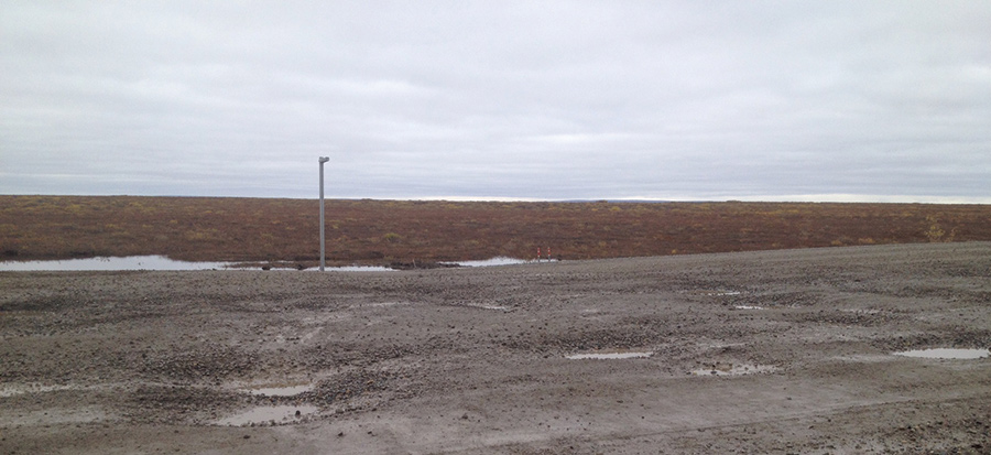
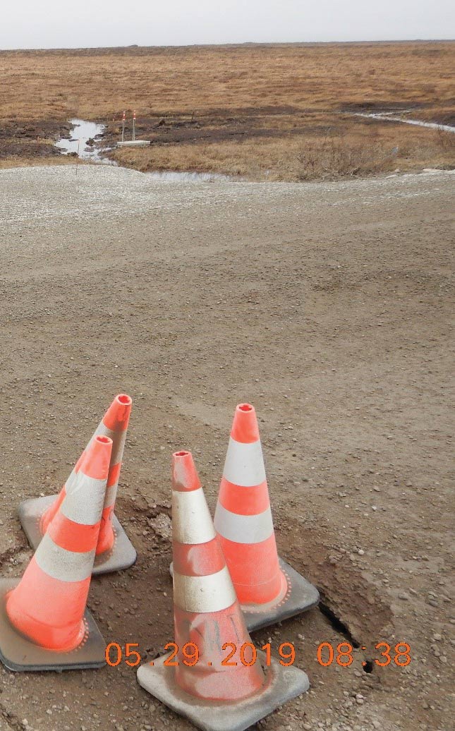
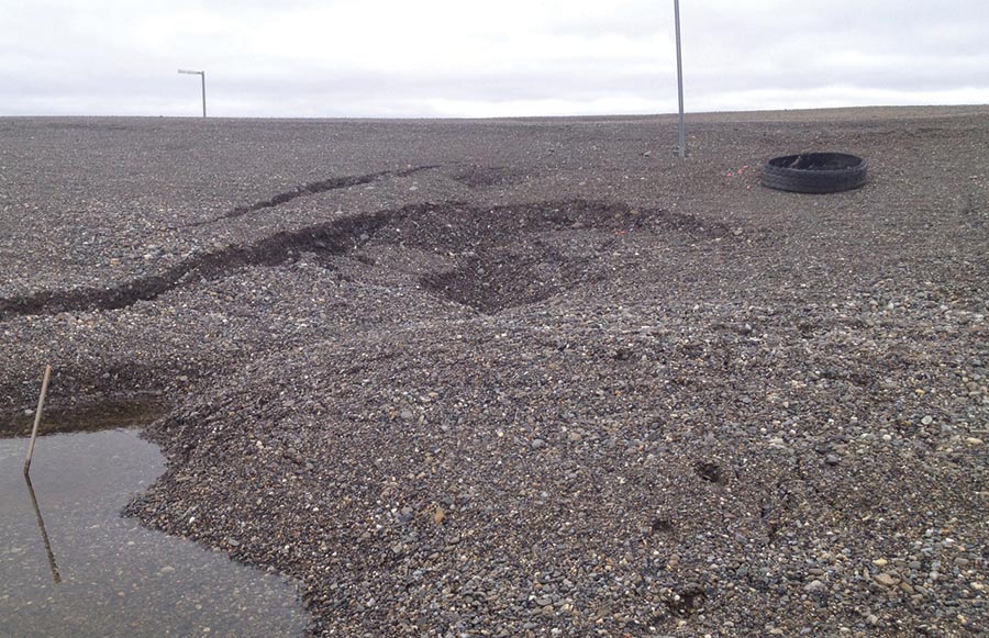
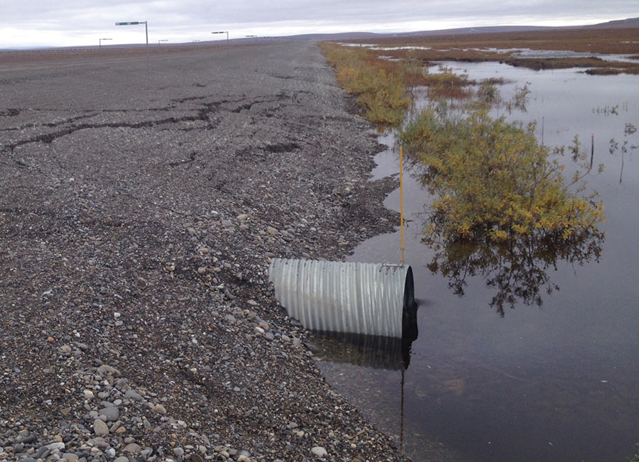
As temperatures on the North Slope climb each year, the existing infrastructure has suffered in some areas. Maintenance superintendents report to Currey that they’ve had to repair the same sections of roads more frequently than they used to—and the repairs are more significant. “The temperature of permafrost has increased,” Currey says. “It’s still pretty cold by permafrost standards, but it’s much warmer than it used to be.”
In particular, maintaining drainage features is vital as temperatures rise. “If permafrost does thaw, it tends to do it at the toes of the slope where a new road or embankment is sitting on top of the existing tundra and permafrost, so we tend to change the drainage patterns and create ponds alongside the road,” Currey says.
Expansive infrastructure could be coming to the state’s most prominent wildlife refuge. In September President Donald Trump’s administration announced plans to open the entire coastal plain of the Arctic National Wildlife Refuge (ANWR) for oil and gas exploration. In doing so, the Interior Department’s Bureau of Land Management moved closer to holding an oil and gas lease sale for the coastal plain, which includes 1.6 million of ANWR’s 19.3 million acres. The administration’s preferred plan includes construction of as many as four airstrips and numerous well pads in addition to 175 miles of roads, vertical supports for pipelines, a seawater-treatment plant, and a barge landing and storage site.
A leasing plan is in the works, so exactly what may happen in ANWR is unknown, including what entities would be responsible for completing various projects or providing funds.
“The Alaska Industrial Development and Export Authority… supports developments and funds construction and then gets paid back by fees or royalties over time. That’s how the road to Red Dog Mine was funded, and then over the years the Red Dog Mine has paid a ‘toll,’ essentially. It’s tough to say what would happen, but that’s one way [infrastructure in ANWR] could be funded,” Currey says. ![]()