n the vast expanse of Alaska, the interplay of extreme weather, brutal winter freezes, summer precipitation, and shifting climate patterns is profoundly affecting delicate tundra and coastal ecosystems. These environmental transformations not only have ecological repercussions but also striking implications for human communities. Alaska Native communities, residing in remote regions, find themselves increasingly vulnerable to these shifts. So what can be done to safeguard these lands and preserve cultural heritage in the face of such challenges?
The first step is having the scientific evidence to document and better understand the hazards these communities face. This enables communities to access needed resources and make appropriate decisions to address immediate and long-term threats. One critical piece of data is lidar mapping. Using advanced remote sensing laser technology, lidar is used to map surface features on the ground—such as signs of permafrost, floodplains, beaches, trees, and community infrastructure—to deliver high-resolution elevation models for precision analysis. These data can address multiple real-world challenges. Better flood modeling and erosion scenarios lead to improved disaster response and engineering strategies for mitigation.
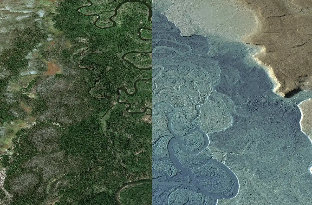
Photo Credit: NV5
Once all communities in the region are mapped with lidar, the borough expects to use this data to support wildfire risk identification, increase accuracy of avalanche modeling to protect regional and local transportation, and address tsunami and flooding risk in coastal areas. This data will also support UAF’s research into habitat changes that could impact the salmon population, which is essential to the subsistence lifestyle and the commercial fishing industry.
“Without data, communities are ineligible for grant funding to implement solutions to natural hazards and have little information for making decisions on what responses are best,” says Jacquelyn Overbeck, Alaska regional geospatial coordinator at the National Oceanic and Atmospheric Administration (NOAA) Office for Coastal Management, which is collecting lidar in communities in Alaska to support coastal managers and other partners. “Having access to lidar enables communities and scientists to work together on risk assessment to better understand the immediate and long-term threats they face. This then informs what engineering solutions are needed, which must be included in local hazard mitigation plans to make projects eligible for certain federal funding programs.”
“Many Alaska Native communities are threatened by environmental hazards, which are impacting critical infrastructure and causing entire communities to relocate for the safety of their residents,” says Leslie Jones, geospatial information officer, State of Alaska Geospatial Office. “Lidar data is incredibly important for helping communities identify, mitigate, and proactively address risks. The level of detail made possible with lidar will immediately help many communities fill the gaps in critical data layers that can be leveraged for a wide array of use cases.”
Jones was instrumental in securing a $3 million Federal Emergency Management Agency (FEMA) grant for lidar collection across sixty communities covering over 3,000 square miles that will help add to the data available in the state. Lidar collected under the FEMA grant will assist environmentally threatened communities. Many Alaska Native communities are situated along rivers or coasts, and increased risk of flooding and erosion puts community infrastructure and resources at risk. Highly accurate lidar data will enable state and federal partners to create flood maps and track erosion over time and provide insights into ways to proactively protect the communities, including erosion protection, raising buildings above floodplains, and identifying safe locations for site expansion and relocation.
Beyond the FEMA grant, Jones is focused on expanding lidar coverage and improving access to the data across the state. She coordinates among many entities to “map once and use many times,” in an effort to control costs and eliminate duplicative projects. Jones also oversees the Alaska geoportal where digital map data including lidar data collected across the state is made available publicly.
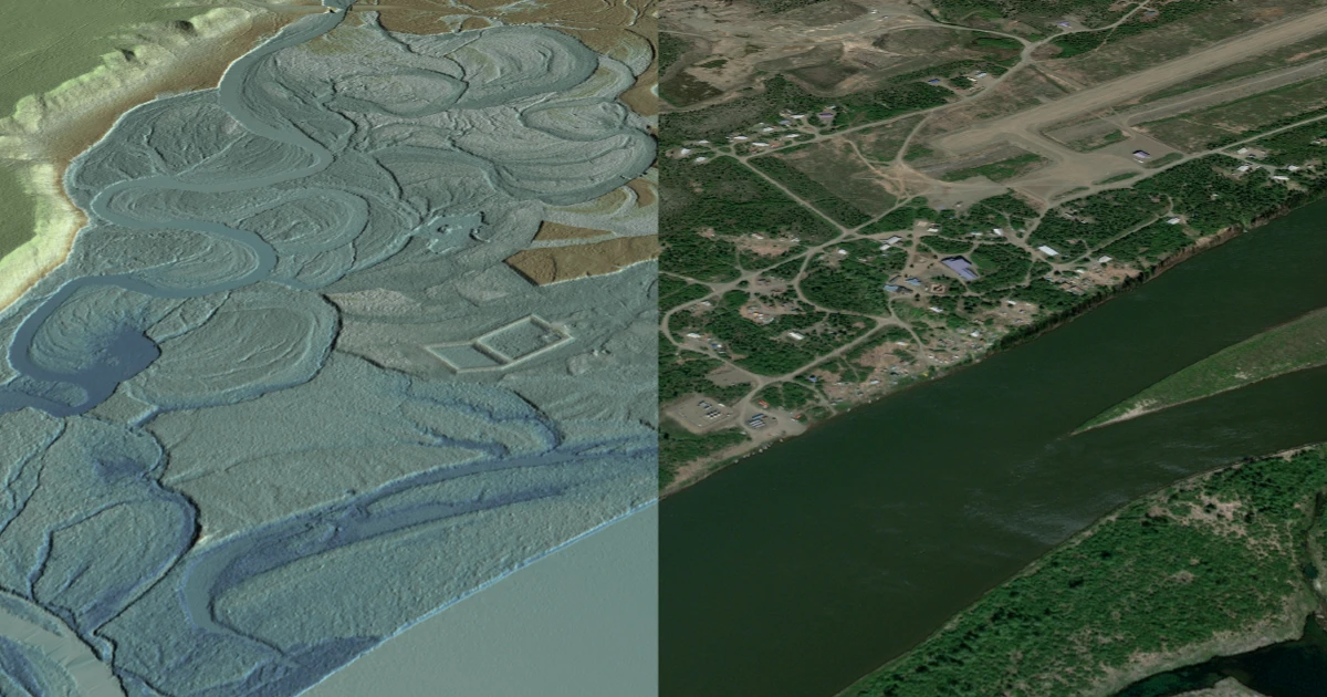
Photo Credit: NV5
A partner in these efforts is NV5, which has more than 65 years of experience working on a variety of mapping projects in Alaska from its office in Anchorage. NV5 is working on a variety of projects with the State of Alaska and federal agencies to collect lidar, which facilitates datadriven decisions across several at-risk communities and expands availability of the data statewide.

To learn more about how lidar is helping transform Alaska communities, contact Adam McCullough, NV5 Alaska Program Manager
adam.mccullough@nv5.com
907-272-4495
www.nv5.com/geospatial